
Vancouver, British Columbia--(Newsfile Corp. - October 29, 2026) - Burrell Resources Inc. (CSE: BURY) ("Burrell" or the "Company") is pleased to announce the completion of a high-resolution drone-borne magnetic survey over its Rainmaker copper project (the "Rainmaker Project" or the "Property") in Lyon County, Nevada, approximately 25 kilometres south of the Yerington Copper District.
Highlights
Four principal magnetic anomalies outlined: approximately 400 line-kilometres of high-resolution drone magnetics identified two magnetic lows and two magnetic highs that correlate closely with alteration mapped on the ground.
Magnetic high beneath the Ridge target: a 2.0 x 0.5 kilometre magnetic high lies directly beneath the east half of the 2.5 x 1.5 kilometre Ridge phyllic alteration zone and is interpreted to reflect potassic alteration at depth, typical of the core zone of porphyry copper systems.
Magnetic lows map alteration and skarn: a 3.5-kilometre-long magnetic low follows a limestone sequence hosting four copper skarn prospects, consistent with magnetite-destructive alteration around a porphyry-skarn system.
IP survey next: approximately 10 line-kilometres of IP are planned to define targets for Rainmaker's first-ever drill program, subject to receipt of a final permit.
The drone-borne magnetic survey, flown by Zonge International, consisted of 70 north-south lines spaced 50 metres apart, flown approximately 40 metres above the ground, for a total of approximately 400 line-kilometres.
The survey outlined four principal magnetic anomalies, two magnetic lows and two magnetic highs, that correlate closely with the alteration mapped on the ground and are interpreted to reflect hydrothermal alteration related to a porphyry-skarn mineral system.
Patrick McGrath, CEO of Burrell, commented: "The drone magnetic survey has given us a much clearer image of Rainmaker's alteration. The results line up closely with the geology mapped on the ground, and the magnetic high beneath the Ridge target is the kind of feature we want to test. Porphyry deposits such as Hercules Metals' Leviathan in Idaho and Hudbay's Ann Mason at Yerington were found or defined with the help of geophysics, and our IP survey is the next step in testing what lies beneath the surface at Rainmaker."
The Four Principal Magnetic Anomalies
Large magnetic low: The largest anomaly is a north-northwest-trending magnetic low approximately 3.5 kilometres long and 1 kilometre wide. It closely follows a 100- to 200-metre-thick limestone sequence, largely altered to marble, that hosts four copper calc-silicate skarn prospects. Sills of intensely silicified, phyllic-altered quartz-feldspar porphyry up to 100 metres thick, with associated calc-silicate skarn alteration, are closely associated with the copper-bearing skarn showings.
Southern magnetic low: A second magnetic low, about 0.75 kilometres wide with a 3-kilometre west-northwest strike, lies along the south margin of the Rainmaker graben in an area of limited outcrop. Calc-silicate skarn alteration, silicification and a copper-bearing skarn crop out at its eastern end, along with thin parallel bands of phyllic-altered mafic volcanic rock. The remainder of the anomaly is partly concealed by post-mineral cover.
Ridge magnetic high: The third anomaly is a 2.0 x 0.5 kilometre magnetic high that strikes east-northeast, parallel to the regional strike of the Rainmaker graben and close to its north contact. It lies directly beneath the east half of the 2.5 x 1.5 kilometre exposure of phyllic alteration that forms the Ridge target. The west half of the phyllic alteration overlaps the large magnetic low and is partly concealed by post-mineral cover.
Western magnetic high: The fourth anomaly is a magnetic high with a 2-kilometre north-northwest strike, widening from 100 metres at its south end to 250 metres at its north end. It lies immediately west of, and parallel to, the large magnetic low and is partly concealed by younger volcanic cover.
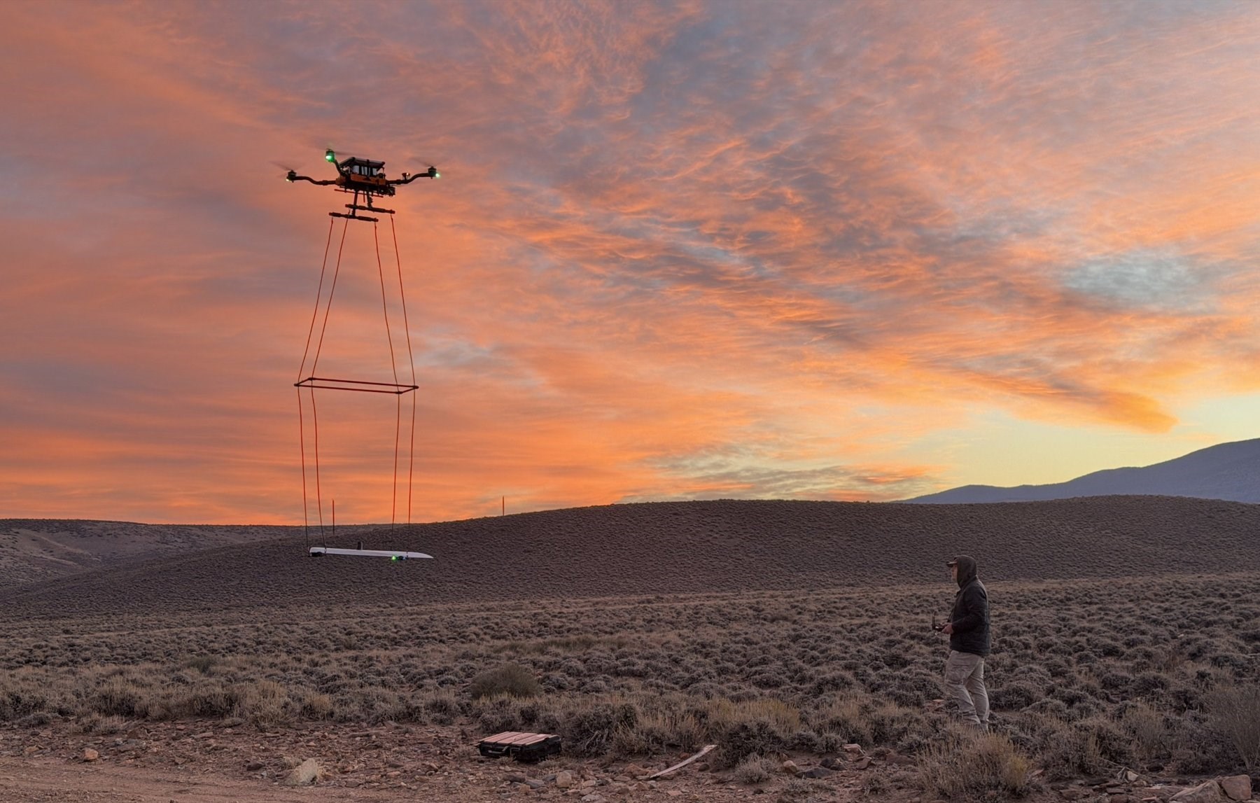
Figure 1: Drone-borne magnetometer survey in progress at the Rainmaker Project. The survey was flown by Zonge International Inc. of Reno, Nevada.
To view an enhanced version of this graphic, please visit:
https://images.newsfilecorp.com/files/12703/321444_2954901b74c2bb78_001full.jpg
Interpretation
The magnetic data have been compared with the 1:5,000 and 1:20,000 scale geological maps prepared by Tom Turner, the Company's technical advisor, from approximately two months of field mapping. Unaltered Triassic mafic volcanic rocks, the predominant rock type in the Rainmaker graben, are moderately magnetic, as are biotite-altered volcanic and sedimentary rocks and thin potassic-altered monzonite dikes east of the Ridge target. Where these rocks have been affected by phyllic (quartz-sericite-pyrite) or argillic (quartz-clay-pyrite) alteration, pyrite has replaced the magnetite and the rocks are non-magnetic. This intense, texture-destructive alteration is typical of porphyry copper systems, where it commonly forms magnetic lows (Clark et al., 2003). The two magnetic lows at Rainmaker are interpreted to correlate with the mapped extent of phyllic to argillic alteration.
The magnetic high beneath the east half of the Ridge phyllic alteration is unusual for such a large area of intense phyllic alteration. Potassic alteration, which typically forms the hotter core of a porphyry system, has already been mapped in thin porphyry dikes east of the Ridge target and in biotite-altered rocks along the north margin of the phyllic alteration. The Company interprets the magnetic high to represent a potassic alteration shell at depth beneath the phyllic alteration; in porphyry systems, copper mineralization is often found along the outer margin of the potassic shell.
The Company's preliminary exploration model for the observed geology and magnetic anomalies postulates that the magnetic high represents potassic alteration at depth capping a quartz-feldspar porphyritic monzonite stock with the potential to host porphyry-style copper mineralization. The Ridge phyllic alteration formed along a series of extensional faults at the north margin of the Rainmaker graben. Hydrothermal fluids flowing upward encountered the chemically reactive limestone just west of the potassic alteration, and the resulting magnetite-destructive skarn alteration formed the large, elongate magnetic low that follows the limestone. The southern magnetic low also follows the graben margin, suggesting that extensional faults along the south side of the graben may also have channelled hydrothermal fluids.
The Role of Geophysics: Comparable Porphyry Systems
Porphyry copper deposits are commonly partly or wholly concealed, and geophysics plays a central role in finding them. Magnetic surveys map alteration and rock types, while IP surveys detect disseminated pyrite in the alteration shells that form a large "halo" around copper mineralization. Two systems cited by Burrell's technical team illustrate this approach:
Leviathan, Hercules project (Idaho): Hercules Metals Corp. discovered the Leviathan porphyry copper system in 2023 by drilling a deep IP chargeability anomaly beneath a near-surface silver system. Burrell's technical team considers Rainmaker to share key geological characteristics with Hercules: Triassic volcanic host rocks intruded by porphyry-related intrusions, widespread phyllic alteration interpreted to represent the upper levels of a porphyry system, and potential for skarn mineralization.
Ann Mason, Yerington District (Nevada): Hudbay Minerals' Ann Mason deposit, approximately 25 kilometres north of Rainmaker, is described by Hudbay as one of the largest undeveloped porphyry copper deposits in North America. Ann Mason lies within a magnetic low on the flank of a magnetic high and is surrounded by a large IP chargeability anomaly reflecting its pyrite halo.
Burrell's technical team also considers the Rainmaker graben comparable to the smaller and more deeply eroded Mason Graben at the south margin of the Yerington District, a 2-kilometre-wide graben of Triassic mafic volcanic rocks with interbedded limestone between the Singatse and Shamrock batholiths. The Mason Graben hosts nine known copper skarns, eight of which had historic production between 1880 and 1929. At Rainmaker, limestone beds up to 200 metres thick have been largely altered to marble, skarn and silica, and several skarn prospects have been identified.
In addition, Rainmaker's targets are hosted by iron-rich mafic volcanic rocks. Such rocks are recognized as favourable hosts for higher-grade porphyry copper mineralization because iron in the rock helps precipitate copper sulphides from the mineralizing fluids; host rocks of this type contain much of the ore at several of the world's highest-grade porphyry deposits, including El Teniente (Chile), Resolution (Arizona) and Oyu Tolgoi (Mongolia) (Sillitoe, 2010).
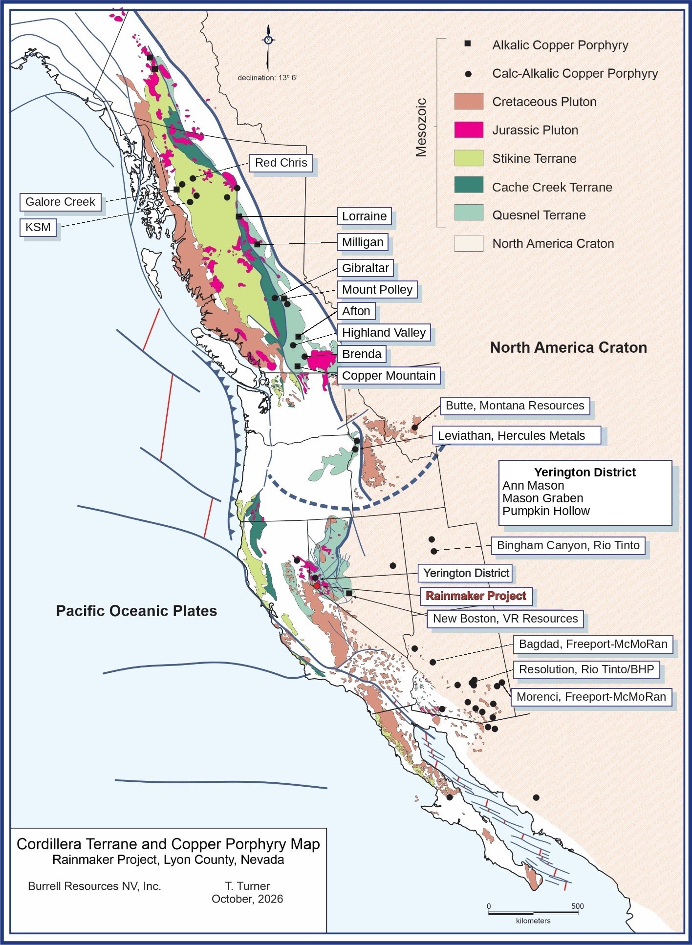
Figure 2: The Rainmaker Project in the context of Mesozoic terranes and porphyry copper deposits of the North American Cordillera, including the Yerington District, Leviathan and major porphyry copper deposits of the western United States and British Columbia (map by T. Turner, Turner Exploration LLC, October 2026). Deposit locations are approximate and compiled from public sources.
To view an enhanced version of this graphic, please visit:
https://images.newsfilecorp.com/files/12703/321444_2954901b74c2bb78_002full.jpg
Next Steps: Induced Polarization Survey
The next phase of exploration is an IP survey of approximately 10 line-kilometres along five lines crossing the Ridge target, the magnetic anomalies and nearby copper-skarn prospects. The survey is designed to detect disseminated sulphide mineralization beneath the oxidized and leached surface rocks to a depth of approximately 400 metres, and is subject to receipt of a final permit.
Results of the IP survey will be integrated with the magnetic data and geological mapping to define targets for a reverse-circulation (RC) drill program, which will be subject to receipt of the required drill permit.
Site Visit
During the second week of October 2026, Patrick McGrath, CEO, Lawrence O'Connor, RM-SME, a director of the Company and its Qualified Person, Tom Turner, the Company's technical advisor, and Huitt Tracey, Investor Relations, visited the Rainmaker Project. The team field-checked features identified in the magnetic survey, reviewed the planned IP lines and planned the next phase of exploration.
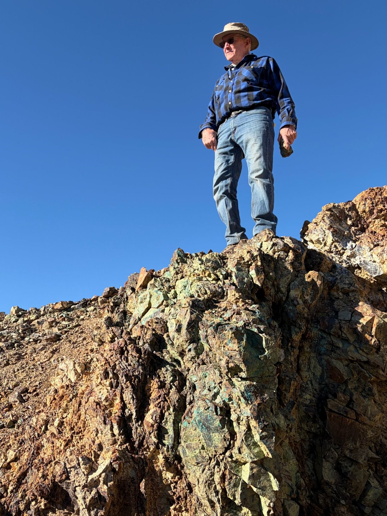
Figure 3: Lawrence O'Connor, Qualified Person, on a copper-oxide-stained outcrop at the Rainmaker Project.
To view an enhanced version of this graphic, please visit:
https://images.newsfilecorp.com/files/12703/321444_2954901b74c2bb78_003full.jpg
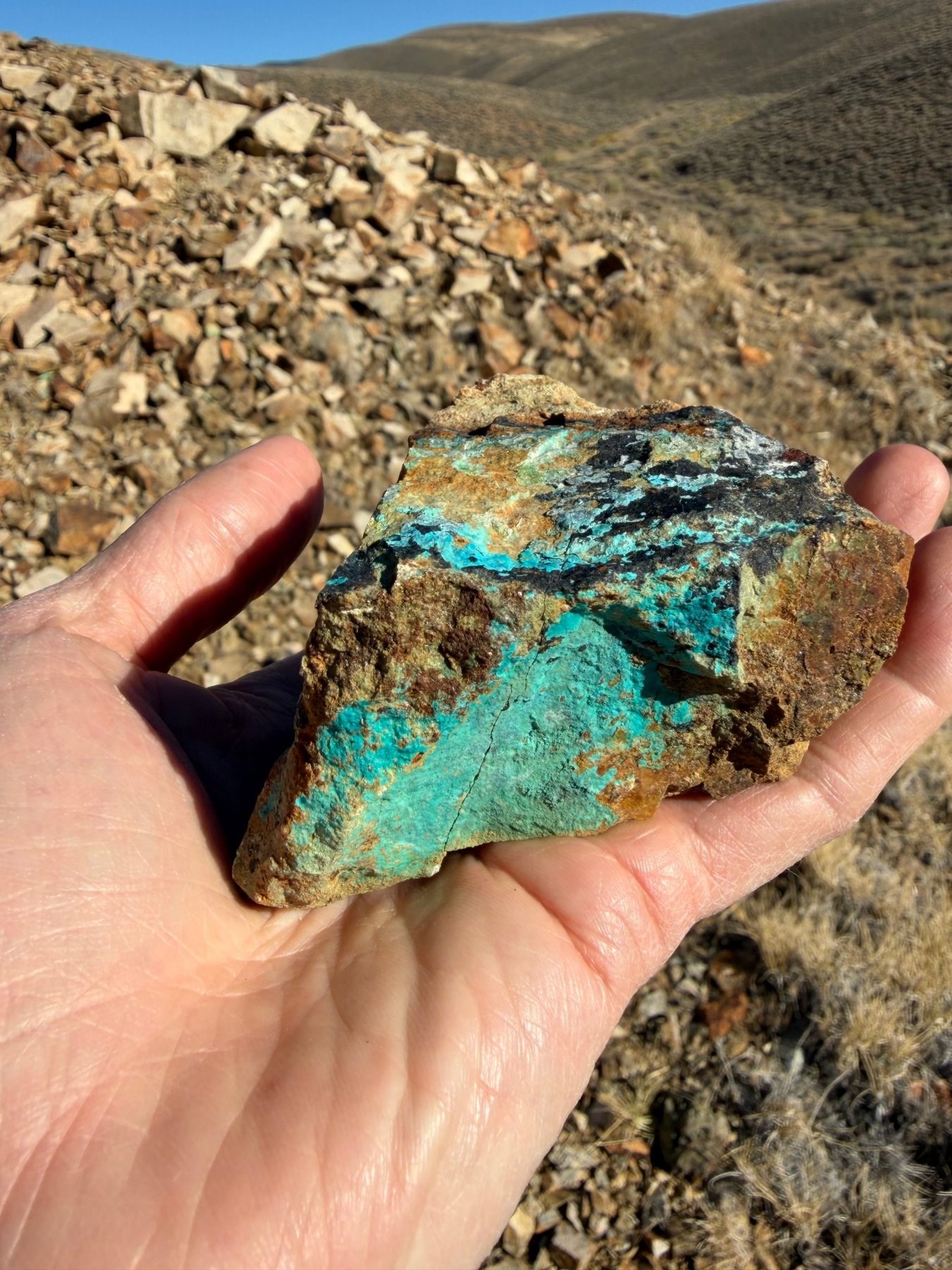
Figure 4: Copper oxide minerals in a hand specimen from the Rainmaker Project. Selected specimens are not necessarily representative of mineralization on the Property.
To view an enhanced version of this graphic, please visit:
https://images.newsfilecorp.com/files/12703/321444_2954901b74c2bb78_004full.jpg
Qualified Person
Lawrence O'Connor, RM-SME, a director of the Company and a "qualified person" within the meaning of National Instrument 43-101 - Standards of Disclosure for Mineral Projects ("NI 43-101"), has reviewed and approved the scientific and technical information contained in this news release. Mr. O'Connor is not independent of the Company.
About Burrell Resources Inc.
Burrell Resources Inc. is a mineral exploration company listed on the Canadian Securities Exchange under the symbol "BURY". The Company is focused on the acquisition and exploration of prospective copper and precious metal projects in Nevada. More information can be found at www.burrellresources.com.
For more information, please contact
Patrick McGrath, CEO
Phone: (832) 499-6009
Email: pmcgrath@burrellresources.com
Huitt Tracey, Investor Relations
Phone: (604) 537-2094
Email: htracey@burrellresources.com
References
Clark, D. A., Geuna, S., and Schmidt, P. W., 2003. Exploration and Mining Report 1073R, Predictive Magnetic Exploration Models for Porphyry, Epithermal and Iron Oxide Copper Gold Deposits: Implications for Exploration. CSIRO Exploration and Mining, North Ryde, NSW, Australia.
Sillitoe, R. H., 2010, Porphyry Copper Systems: Economic Geology, Vol. 105, pp. 3-41, Society of Economic Geologists, Denver, Colorado.
Cautionary Note Regarding Adjacent, Nearby and Comparable Properties
This news release contains information regarding mineral deposits, historic production and exploration results on properties that are not owned or controlled by the Company, including the Yerington Copper District, the Ann Mason deposit and the Mason Graben in Nevada, the Hercules project in Idaho, the El Teniente, Resolution and Oyu Tolgoi deposits, and the other deposits shown in Figure 2. This information is taken from public disclosure by the owners of those properties and other public sources, and the Company's qualified person has not verified it. Historic production figures are historical in nature and have not been verified. Mineralization on such properties is not necessarily indicative of mineralization on the Property. The comparisons describe geological characteristics only and are not intended to suggest that the Rainmaker Project hosts, or will host, mineralization of similar grade, size or type. No drilling has been done on the Rainmaker Project, the Property does not host any mineral resource or mineral reserve, and the exploration targets described in this news release are conceptual in nature. There is no certainty that further exploration will result in the discovery of a mineral resource or mineral reserve.
Forward-Looking Information
This news release contains "forward-looking information" within the meaning of applicable Canadian securities legislation, including statements regarding the interpretation of the magnetic survey results, the planned IP survey and its timing, scope and results, the receipt of permits, the definition of drill targets, the planned drill program, and the prospectivity and geological potential of the Rainmaker Project. Forward-looking information is based on assumptions and is subject to known and unknown risks and uncertainties, including exploration risk, the risk that geophysical anomalies do not reflect economic mineralization, permitting and regulatory risk, financing risk and commodity price risk, that could cause actual results to differ materially from those expressed or implied. Such information is provided as of the date of this news release and, except as required by law, the Company undertakes no obligation to update it. Readers are cautioned not to place undue reliance on forward-looking information.
The Canadian Securities Exchange has neither approved nor disapproved the contents of this news release, and neither the CSE nor its Market Regulator (as that term is defined in the policies of the CSE) accepts responsibility for the adequacy or accuracy of this news release.
To view the source version of this press release, please visit https://www.newsfilecorp.com/release/321444
Source: Burrell Resources Inc.